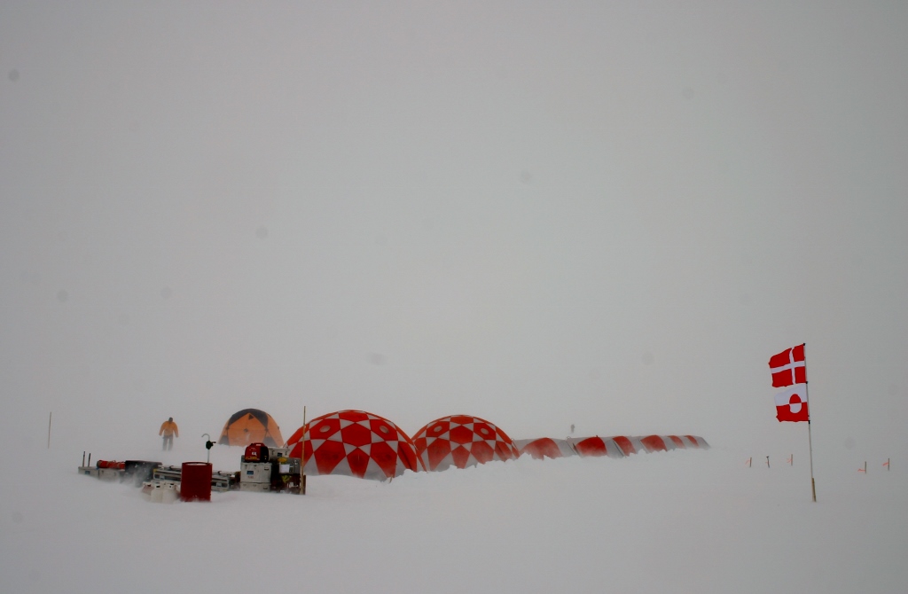
In summer 2017, the Geological Survey of Denmark and Greenland (GEUS) undertook an expedition to Camp Century to initiate the Camp Century Climate Monitoring Programme. Here is Project manager William Colgan’s report from the successful expedition. The science team achieved 95 % of what they set out to do despite challenging weather conditions.
Logistics
A ski-equipped charter aircraft transported 3200 kg of equipment and supplies to the ice-sheet site. The camp consisted of three common tents and six personal tents. The team spent 82 person-days on site between July 19 and August 3. During this period, air temperatures ranged between -13 and 2°C and the average wind speed was 8 m/s. There were sustained storm conditions the majority of the time. Blue sky was only visible on one in four days. Demobilization of ice-sheet equipment is expected to be finished this month.
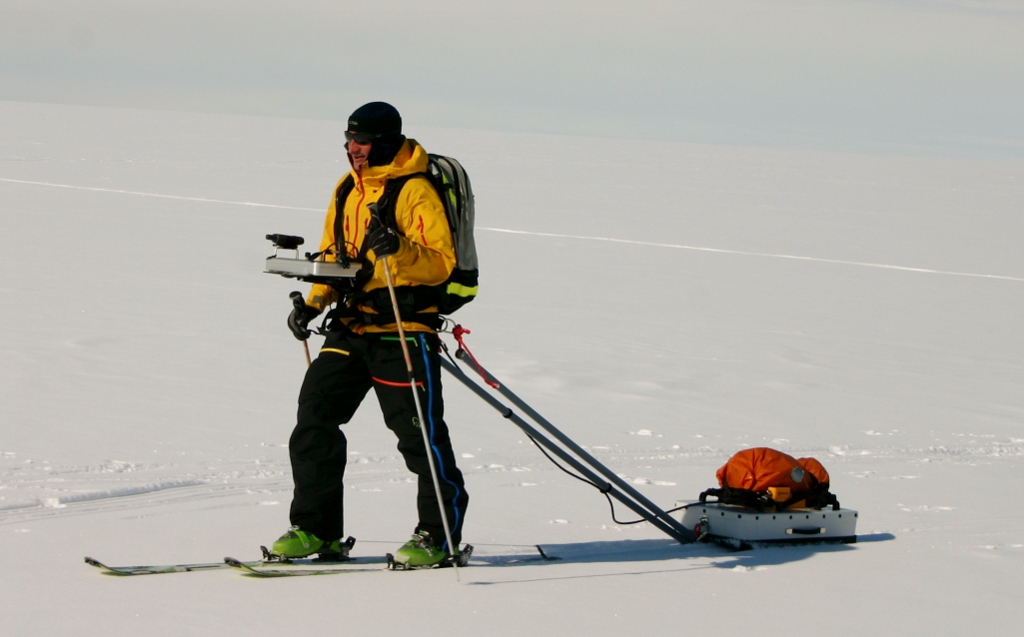
Ice-Penetrating Radar
Over 80 km of ice-penetrating radar profiles in a grid pattern over the debris field were collected. The sub-surface debris field is approximately 2 km in diameter. The ice-penetrating radar data will allow mapping the depth and extent of abandoned wastes across the debris field. The sophisticated, but relatively lightweight, radar system was towed by researchers on cross-country skis.
Ice Drilling
The team drilled five boreholes totaling 171 m depth. These boreholes were used to recover ice samples and install instrumentation. However, air temperatures made ice coring difficult. A two-day period with air temperatures reaching 2°C forced a suspension of ice drilling. In these warm conditions surface melt quickly froze to moving drill parts when the drill was lowered into very cold winter ice.
Ice Samples
Ice samples were recovered for every 10 cm depth down to 40 m depth. These 150 kg of ice samples will be shipped back to Copenhagen for analysis of radionuclide contents. Carefully bagging and logging the samples was challenging on the open ice sheet. During the recovery of these samples, pressurized hydrocarbon vapors were released from the borehole.
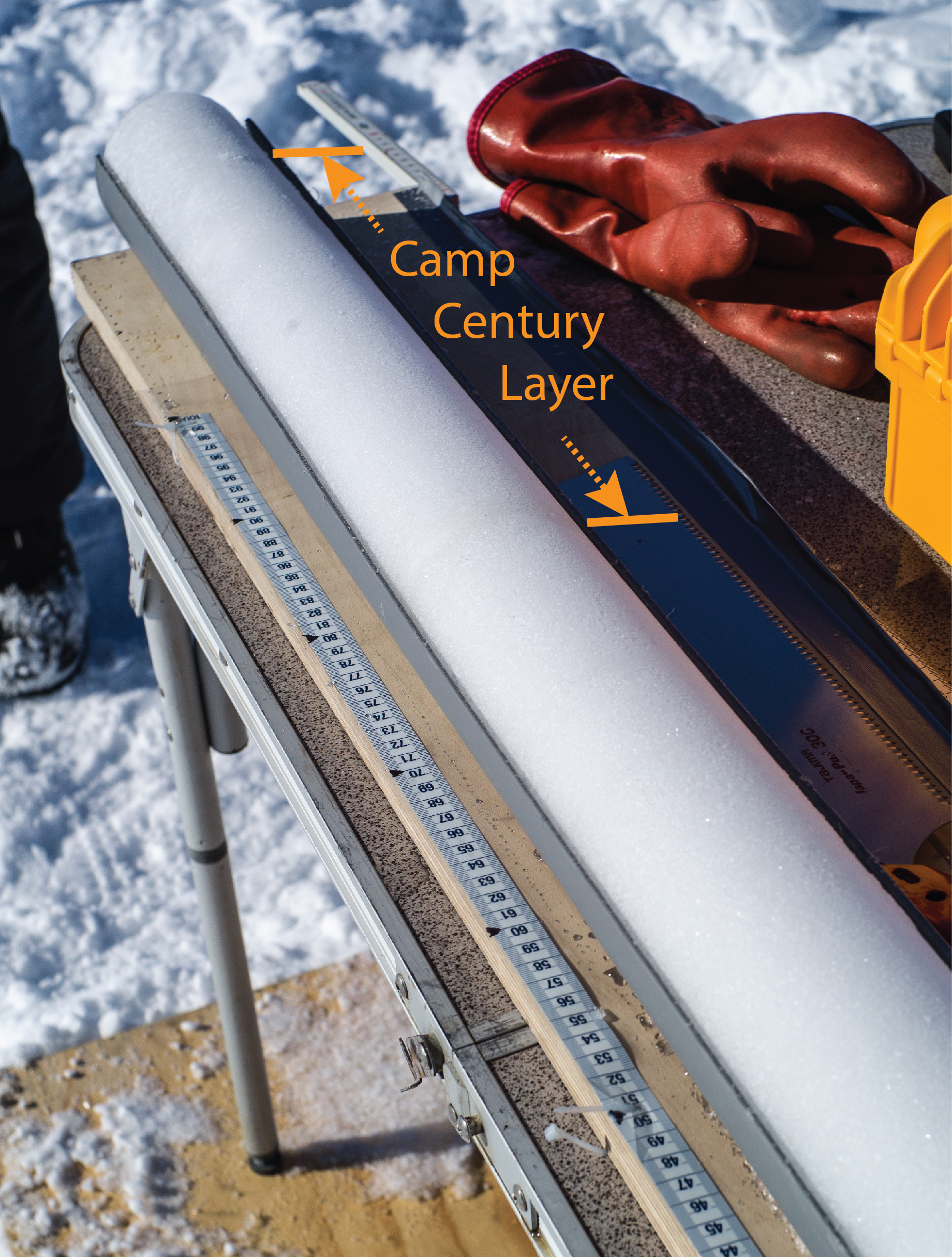
Firn Density
The team measured the density of the porous near-surface ice sheet layer, known as firn, to at least 60 m depth at locations inside and outside the debris field. Comparing these vertical density profiles allows the team to identify which ice-sheet layers were disturbed by site activities. The ice layers associated with the early 1960s were slightly discolored.
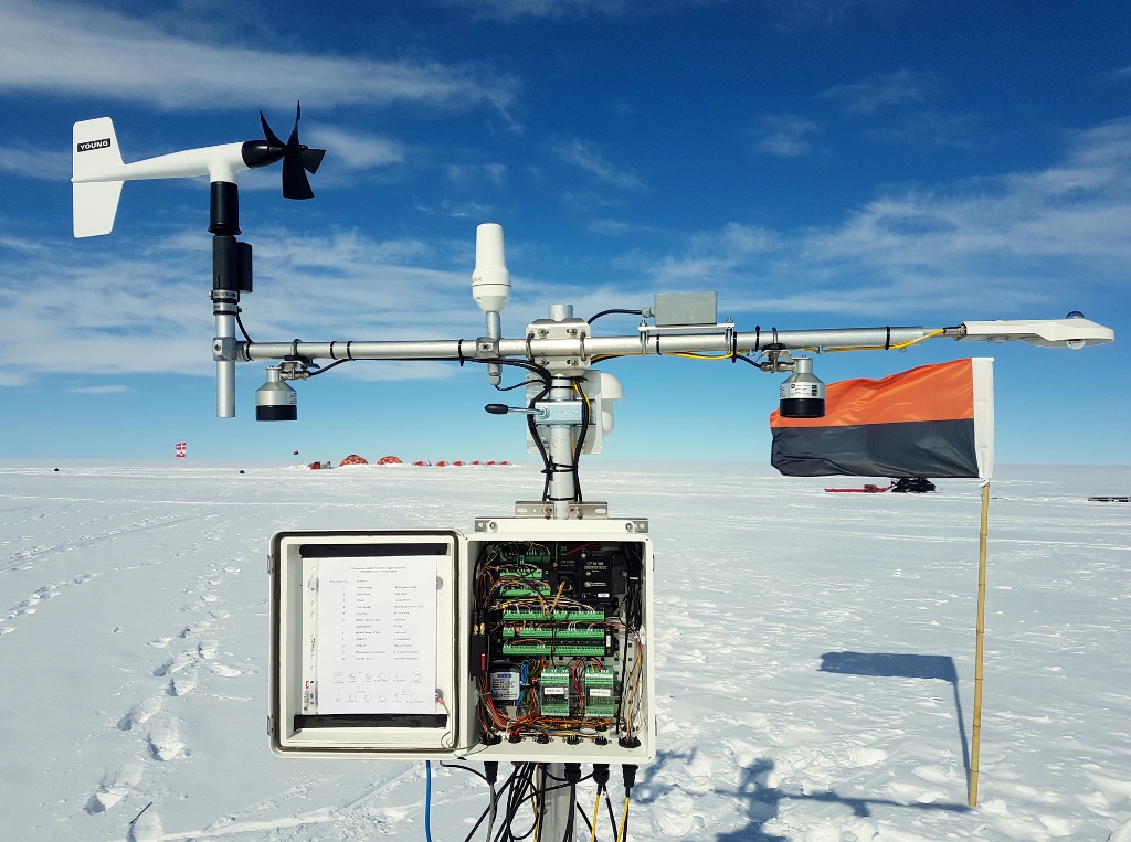
Instruments
Three autonomous stations were installed. They will now satellite-transmit climate and ice measurements to Copenhagen each day. Firstly, a climate station recording long-term meteorological measurements each hour. Secondly, a firn temperature station recording ice-sheet temperatures down to 73 m depth each day. Finally, a firn compaction station recording how fast snow is compressing into ice each day. These measurements allow not only real-time monitoring of the site, but also calibrating a computer model to predict how the firn will evolve in the future. The data from the climate station is available to view here.
Collaborations
The expedition team consisted of three personnel from GEUS, a representative from Asiaq Greenland Survey, a radar specialist from University of Fribourg and an ice-drilling specialist from the University of Wisconsin. I would like to thank the whole team for a successful expedition, as well as Thule Air Base for providing excellent logistical support.