The site of the former Camp Century station was shortly revisited in May 2019 for maintenance of the climate station and instruments. The results of the ice-penetrating radar survey have been published and the data are available for download.
Ice-penetrating radar
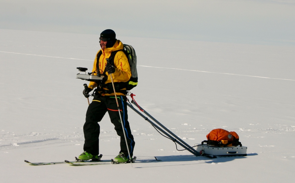
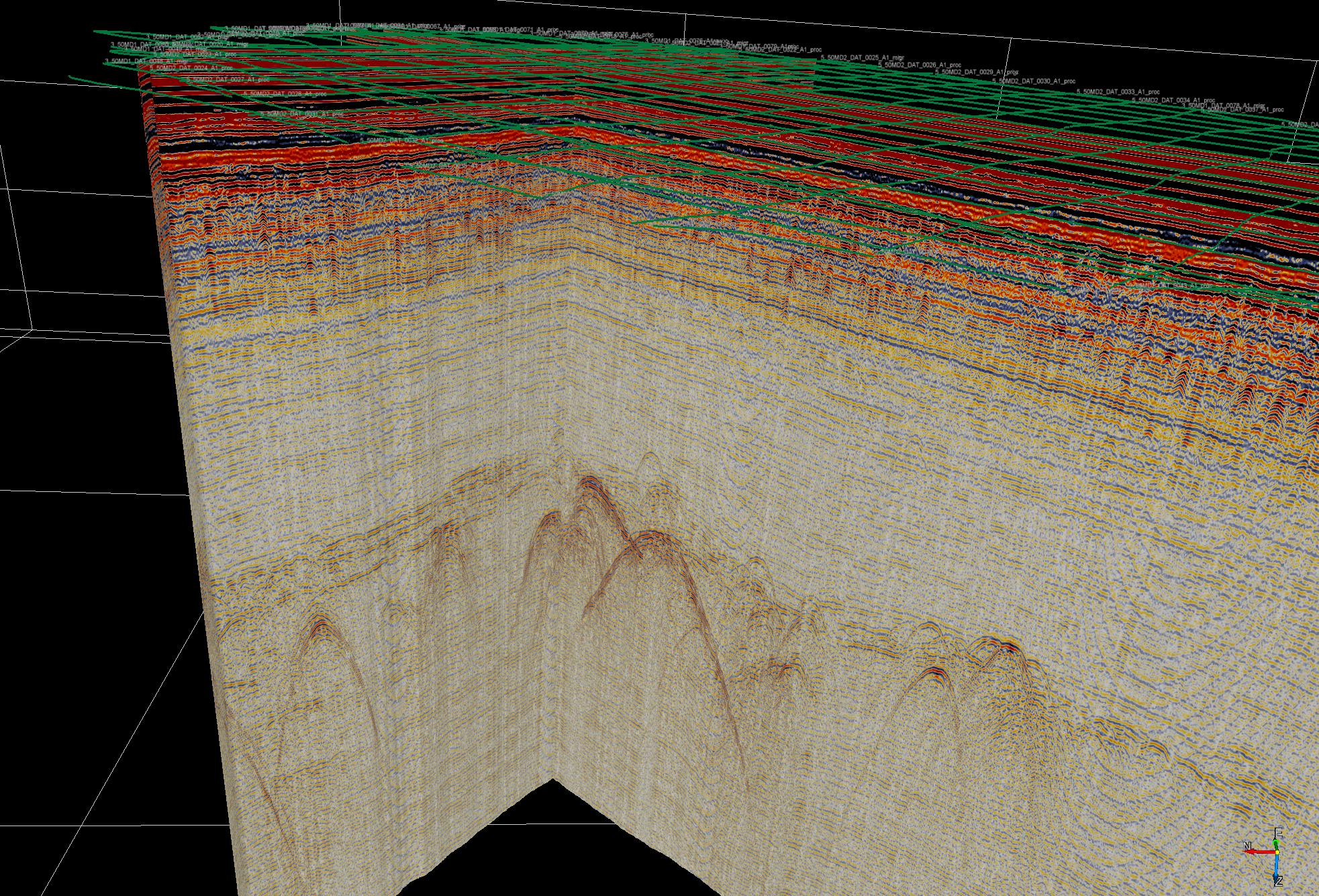
As part of the expedition to Camp Century in the summer of 2017, over 80 km of ice-penetrating radar profiles were collected in a grid pattern over the debris field.
The radar data have since been processed and analyzed at the Geological Survey of Denmark and Greenland (GEUS) led by Senior Researcher Nanna B. Karlsson, and the results have now been published as a peer-reviewed scientific article as well as in a technical report in Danish. The data are also available for download.
The ice-penetrating radar data have made it possible to map the depth and extent of the abandoned waste across the debris field. It shows that the extent of the subsurface debris field is approximately circular with a radius of less than 1 km.
The tunnel network infrastructure is readily visible in the radar data, most of them at depths of 45 to 55 meters. All the tunnels depicted in the as-built map of Camp Century can be identified in radar reflections and there is no sign of unmapped tunnels. The horizontal extent of the mapped tunnel network is approximately 500 by 500 meters.
Some down warping of layers identify now-collapsed liquid sumps that once stored water, sewage, glycol and hot waste. The hot waste sump was smaller than the others were and there is no sign of strong reflections from it. Analysis near the glycol sump suggests liquid hydrocarbons are likely present at 130 meters depth. The glycol was used for cooling and has a low freezing point explaining why it could still be liquid.
The study also estimates that the ice has displaced Camp Century approximately 232 meters West-southwest since its construction in 1959.
Visit to Camp Century
The Camp Century site was revisited in May 2019 by a ski-equipped aircraft for maintenance of the monitoring instruments. The team from GEUS flew in and out the same day.
Since the installation of instruments in the summer of 2017 approximately two meters of snow had fallen. The existing instruments were raised and serviced and one new instrument was installed.
The instruments are a climate station recording long-term meteorological measurements every hour, a firn temperature station recording ice-sheet temperatures down to 70 meters depth each day, a firn compaction station recording how fast snow is compressing into ice each day and finally a new high precision GPS was installed.
The instruments transmit the weather and snow measurements to GEUS each day by satellite. These measurements ensure a real-time monitoring of the site, and will be used for calibrating a computer model to predict how the near-surface snow layer will evolve in the future. The climate modelling and projections are expected to be published in 2020.
The data from the climate station is available here.
In 2021 the monitoring instruments at Camp Century will be visited for maintenance again.

Learn more
Peer-reviewed open access scientific article Ice-penetrating radar survey of the subsurface debris field at Camp Century, Greenland published in Cold Regions Science and Technology.
Technical report Camp Century radarundersøgelser in Danish.
Data from the climate station at Camp Century.